![]() King Philip's War & the
Colonial Contact Period in Warren, RI
King Philip's War & the
Colonial Contact Period in Warren, RI
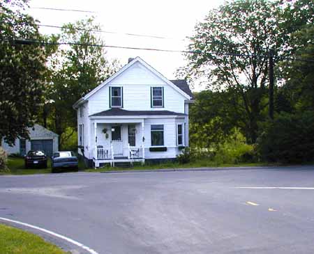
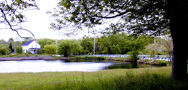
On the morning of June 23rd, more homes were ransacked and burned. Settler John Salisbury shot and wounded a Native warrior. The next day, seven settlers, including Salisbury, were attacked and killed near Swazey Corner, near what is now the intersection of Milford and Hortonville Road in Swansea (pictured on the right), when they left the Bourne garrison. The severed hands and heads of these men were discovered on June 30th hanging on poles along the bank of the River at Wading Place where the trail crossed the Kickemuit River in Warren on what is now Schoolhouse Road (photo, below right).
|
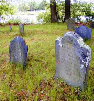
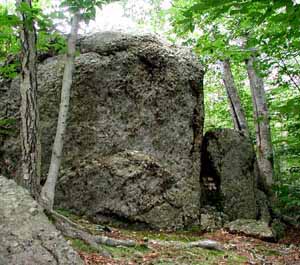
In the following fifteen months, what came to be known as the King Philip War, spread west and north into Connecticut, Massachusetts, Maine and New Hampshire and resulted in the deaths of between six and eight hundred English soldiers and thousands of Natives. Providence was burned to the ground. The graves of some of the soldiers who fought in the subsequent King Philip's War are said to exist at the Kickemuit Cemetery (left) on Serpentine Road just to the south of the Wading Place. |
|
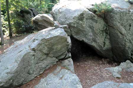
King Philip's warriors were believed to have taken refuge in a natural cave (pictured on left) in Norton, MA, as they withdrew in advance of the militia from Plimoth and Taunton under the command of Captain Benjamin Church. The cave can be found at the end of Stone Run Drive (marked "private" but open to public access) off of Plain Street just west of Bay Road in Norton. (Take Route 495 to Exit 9, and proceed north on Bay Road to Plain Street past Winnecunnet Pond). King Philip frequently visited Winnecunnet on fishing and hunting trips staying in the cave at Great Rocky Hill. |
In the end, Benjamin Church organized a search party
which hunted down and killed King Philip near Mount
Hope on August 12, 1676. His body was beheaded and quartered and his head
subsequently taken to Plymouth where it was displayed on a pole for a
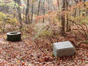
generation. In December 1877, the Rhode Island Historical Society placed a
stone marker (see photos) in the Miery Swamp near a spring that was close
to the traditional site of Philip's death. This site can now be reached from
the road that leads to Cove Camp from Mt. Hope Farm in Bristol. 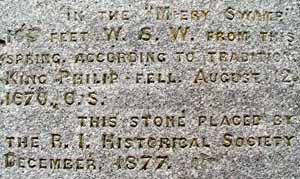
|
|
|
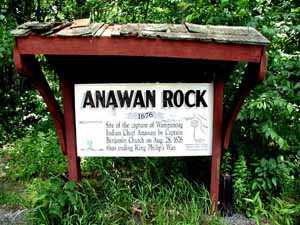
The War that had begun as a premature and
unplanned act of vandalism ended on August 28, 1676, with the capture
of Indian Chief Anawan by Benjamin Church. Anawan Rock is located off of
Route 44, about one half mile east of Route 118 in Rehoboth. The remaining
Natives were either executed, enslaved or scattered to reservations as the
English settlers occupied the remaining Native land in present day
Bristol, RI
. |
|
|