|
|||||||
|
Waypoyset Preserve at The Narrows |
|||||||
|
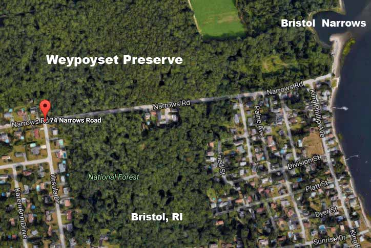
The Waypoyset Preserve is one of 45 land trusts in Rhode Island that have set aside land for preservation. It runs just north of 45 Narrows Road in Bristol to the Bristol Narrows at the mouth of the Kickemuit River in Mount Hope Bay. Trails can be accessed from the Narrows parking lot. This land that has remained much as it was in the 17th century.
|
|||||||
|
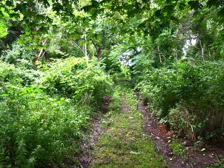
The trail begins at the Narrows parking lot and extends into the woods. |
A stream runs through the property to Mount Hope Bay. |
||||||
|
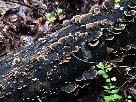
The preserve supports indigenous plant and animals within its boundaries. |
Plants of all type abound. |
||||||
|
Mount Hope Bay borders the Weypoyset Preserve on the east. |
The Touisset portion of Warren is visible across the Bristol Narrows here. |
||||||
|
Click on map below to see a Google satellite map of this location.
A number of parking spaces are available at the Bristol Narrows close to the trail opening to the Preserve.
|
|||||||